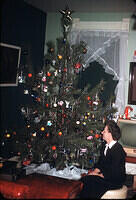
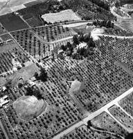
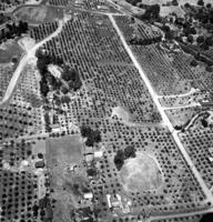
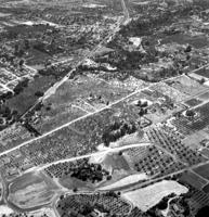
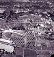
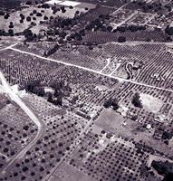
Pinecrest Heights 1954
Photos from 1954 of the Pinecrest Heights neighborhood (now north eastern edge of Los Altos Hills, California) before subdividing the farms into houses. Photos show neighboring farms before subdividing also.
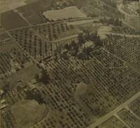
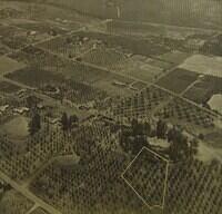
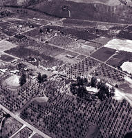
Pinecrest was the DeBell farm defined by the land between Manuella and Miranda and led from roughly Miranda Way and the old driveway off Manuella (still there) down to Estacada -- including all of what is now DeBell road. April Anir is in the old DeBell farm house. The garage was on the Libby (now Yu) property and just torn down in 2009. The "pine crest" still exists somewhat and now has the Water Tank and the Smith house. The trees used to surround an irrigation pond at the top of the hill. The remaining large, old pine trees are on the Harr property including one over 5 ft in diameter. The De Bell house was approached by a driveway up from Manuella. Much of it is still visible as it is an easement for the power lines still running there. The Harr property still has curbs and cement under the dirt as does the water company property.
According to Stretch Anderson: <i>As I recall the story from my Dad, I believe one of the neighbors (Stecker I think, who lived across Miranda, just the right of Carada Ct.) was a honcho at Moffett Field. I think he ordered his fly boys to do some aerial recon training....over his soon to be new homestead. Somehow my Dad found out and Stecker gave him copies.</i> Stretch now lives in Danville and has the original 11x11 photos.
Gallery Stats
- Version: 3.0+
- Albums: 1035
- Photos: 18457
- Hits: 122915
Available RSS feeds
Popular tags
- 1 photos are tagged with mycuz.us gallery genealogy
Random image